Structure Visualization with AR
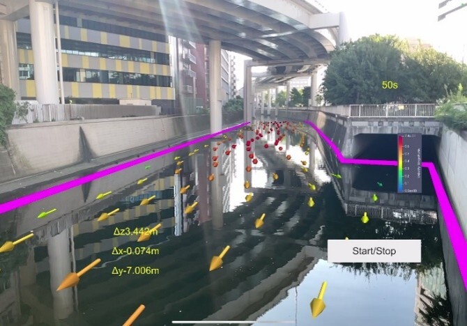
In this research, we visualize civil engineering structures using AR (Augmented Reality). By displaying things that are hard to see in reality as CG through AR, we aim to contribute to more efficient and safer construction work on site and to consensus building with local residents.
AR visualization methods fall broadly into location-based and vision-based approaches. Location-based AR displays CG tied to position information obtained from GNSS (Global Navigation Satellite System) and similar sources. It is highly accurate in open-sky environments where satellite signals are easy to receive.
Vision-based AR displays CG by recognizing specific images or spaces. It is further divided into marker-based and markerless AR. Marker-based AR responds precisely to locations where markers are placed and can display CG there. As a relatively well-established technology it works stably and is easy to adopt, but because physical markers must be installed, it can be unsuitable in places where marker placement is difficult, such as offshore.
Markerless AR can flexibly display information on faces, landscapes, buildings, and more, even where markers cannot be installed due to space or design constraints. However, since it launches AR based on camera images and device information without markers, it requires advanced image analysis. The more sophisticated the AR, the greater the computational load and the more powerful the device required.
Our laboratory has applied the location-based approach to river flow visualization and the marker-based approach to visualizing buried underground pipes.